Geoshot...
UAV Data Processing and Topographic Mapping Services
Revolutionizing Geospatial Solutions
At GeoShot Technologies, we pride ourselves on being pioneers in UAV Data Processing, utilizing cutting-edge technology and innovative workflows to deliver precise geospatial solutions. Our expertise lies in processing high-resolution data collected from UAVs (Unmanned Aerial Vehicles), transforming it into valuable insights that empower decision-making across diverse industries. From urban planning to environmental monitoring, agricultural optimization to infrastructure management, we cater to a variety of sectors with tailored geospatial services.


UAV Data Processing by GeoShot Technologies
Using powerful workstations, we efficiently handle the extensive datasets generated by UAVs, ensuring timely and high-quality results. With a focus on accuracy and efficiency, GeoShot Technologies delivers orthophotos, Digital Elevation Models (DEM), Topographic Mapping, and realistic 3D models, making us a trusted partner for projects requiring city-scale and detailed analyses.
Our Comprehensive UAV Data Services
GeoShot Technologies offers an array of UAV data services designed to meet the unique needs of our clients. Each service is backed by advanced tools, specialized expertise, and a commitment to delivering actionable geospatial intelligence.
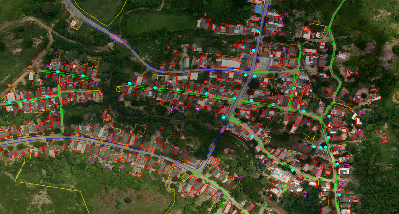
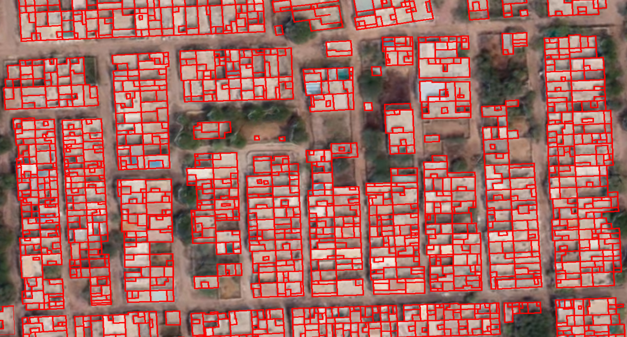
Ground Classification
One of our core capabilities is LiDAR ground classification, which involves detecting and categorizing ground features with remarkable accuracy. Leveraging high-resolution imagery captured by UAVs and advanced classification algorithms, we identify and map:
- Buildings and structures
- Bridges and transportation networks
- Powerlines and utility infrastructure
- Water bodies and natural features
This level of detail is instrumental for urban planners, environmental researchers, and infrastructure managers. By transforming raw UAV data into well-classified outputs, we enable smarter, data-driven decisions.
Transform your LiDAR data with our expert ground classification service. Explore our LiDAR ground and non- ground classification service page for samples and learn more about us at our dedicated website LiDAR Data Services.
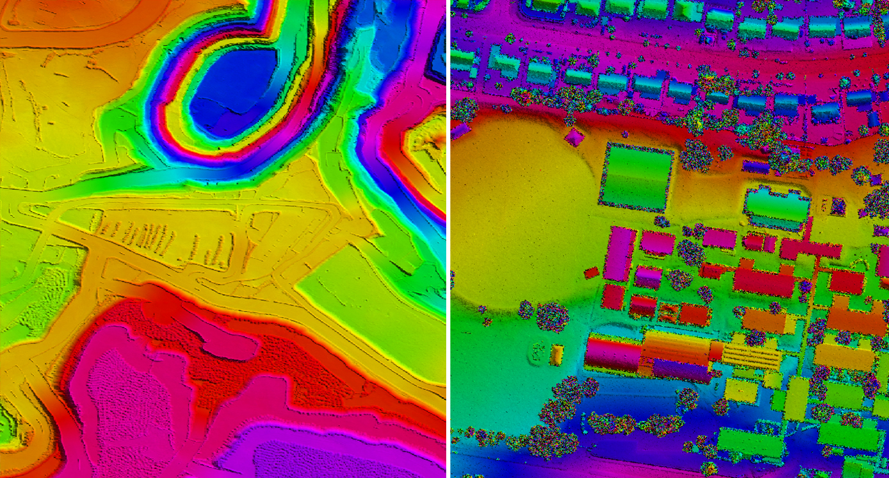
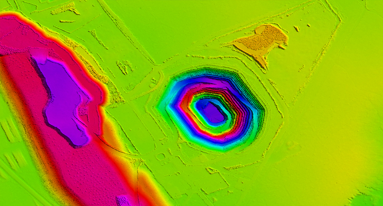
Digital Elevation Models (DEM) and Digital Surface Models (DSM)
Our expertise extends to creating precise Digital Elevation Models (DEM) and Digital Surface Models (DSM) using UAV data. These models represent the topographic and surface features of an area with exceptional detail, aiding projects such as:
- Construction site planning
- Hydrological modeling
- Flood risk assessments
- Terrain analysis for land development
DEM focuses on representing the bare earth, removing vegetation and structures, while DSM includes all surface features. These datasets are invaluable for engineering, environmental, and administrative applications.
Explore our high-quality Digital Elevation Models (DEM) and Digital Surface Models (DSM) on our Digital Elevation Models (DEM) and Digital Surface Models (DSM) service page at our dedicated website LiDAR Data Services to know more about our expertise and see sample data.
Topographic Mapping
With UAV-based Topographic Mapping, GeoShot Technologies generates accurate representations of natural and artificial features within a specific area. These maps include information such as:
- Contour lines
- Vegetation coverage
- Water bodies
- Infrastructure
Topographic mapping plays a crucial role in urban planning, resource management, and infrastructure development. By providing high-quality outputs, we help stakeholders visualize and analyze land use efficiently.
Infrastructure Inspection and Monitoring
Infrastructure management is a critical domain where UAV data processing offers unparalleled advantages. At GeoShot Technologies, we specialize in processing drone data to facilitate:
- Structural inspections
- Monitoring of bridges, roads, and railways
- Utility infrastructure assessments
By identifying potential issues early, we enable proactive maintenance, ensuring safety and operational efficiency.

Vegetation and Crop Health Analysis
Agricultural and environmental sectors benefit significantly from our UAV data processing services. Using multispectral and thermal imagery, we assess vegetation and crop health, enabling stakeholders to:
- Detect diseases and pests early
- Monitor plant growth and productivity
- Optimize irrigation and resource allocation
Our solutions help improve agricultural practices, boost yields, and support sustainable farming initiatives.
Unlock the power of UAV data! Explore our comprehensive UAV Data Processing services including acquisition, orthomosaics, 3D videos, feature extraction, and DEM/DTM/DSM creation. Visit our dedicated website UAV Data Processing for samples and portfolio.
Applications of UAV Data Processing
The versatility of UAV data processing allows it to be applied across various industries. Some prominent applications include:
.png)
Urban Planning and Development
Detailed ground classifications and topographic maps provide insights into land use, enabling urban planners to design efficient and sustainable cities.

Environmental Monitoring
UAV data aids in monitoring ecological changes, assessing vegetation health, and identifying water resource patterns, contributing to conservation efforts.
.png)
Agriculture
From crop health analysis to yield optimization, UAV-based data processing revolutionizes precision agriculture, supporting farmers in maximizing productivity.

Construction and Engineering
Elevation models and topographic maps are critical for construction site planning, terrain analysis, and infrastructure development.

Disaster Management
UAV data helps in assessing disaster-prone areas, enabling effective disaster preparedness and response strategies.
Why Choose GeoShot Technologies?
GeoShot Technologies stands out as a leader in UAV Data Processing for several reasons:
.png)
Expertise
Our team consists of seasoned professionals with extensive experience in geospatial data processing, ensuring high-quality outputs tailored to client needs.

Advanced Technology
We utilize state-of-the-art tools and algorithms to process UAV data, maintaining accuracy and efficiency.

calability
From small-scale surveys to city-scale projects, we have the infrastructure and expertise to handle datasets of any size.

Timely Delivery
We prioritize project timelines without compromising on quality, delivering results within agreed deadlines.

Advantage in Partnering with GeoShot Technologies
Partnering with GeoShot Technologies means gaining access to geospatial intelligence that empowers your business. Our UAV data processing services offer:
- Enhanced decision-making capabilities
- Cost-effective solutions for large-scale data analysis
- Accurate outputs that meet industry standards
With a proven track record of successful projects across multiple sectors, we are your trusted partner in UAV data processing.
Contact GeoShot Technologies
Unlock the full potential of your UAV data with GeoShot Technologies. Whether you need Digital Elevation Models, Topographic Mapping, or detailed ground classifications, our team is here to help.
Contact us today at email.geoshott@gmail.com to discuss your project requirements or request a consultation.
Let’s work together to transform your geospatial data into actionable insights, driving success in your projects and initiatives.
Send a Message
