Geoshot...
Professional Map Illustration Services
Map Illustrations
Expert World Map Illustrators for Stunning Cartographic Solutions
GeoShot Technologies is a leader among illustrated map companies, offering precise and professional map illustrations to meet diverse needs. As expert world map illustrators, we specialize in freehand illustrations, vector maps, 2D campus maps, and 3D campus maps. Our services extend to the creation of advanced 3D vector maps, providing a unique perspective beyond traditional flat representations. Whether you require vector or raster maps, our cutting-edge technology ensures both accuracy and aesthetic appeal.
Our Services
2D Vector Maps
Our 2D vector maps combine precision and simplicity, enhancing spatial awareness. These maps are ideal for educational materials, marketing campaigns, and navigation, offering accurate representations of geographic locations.
2D vector maps are a cornerstone of effective cartography. Their clarity and adaptability make them a popular choice for a wide range of applications, from academic research to commercial projects.
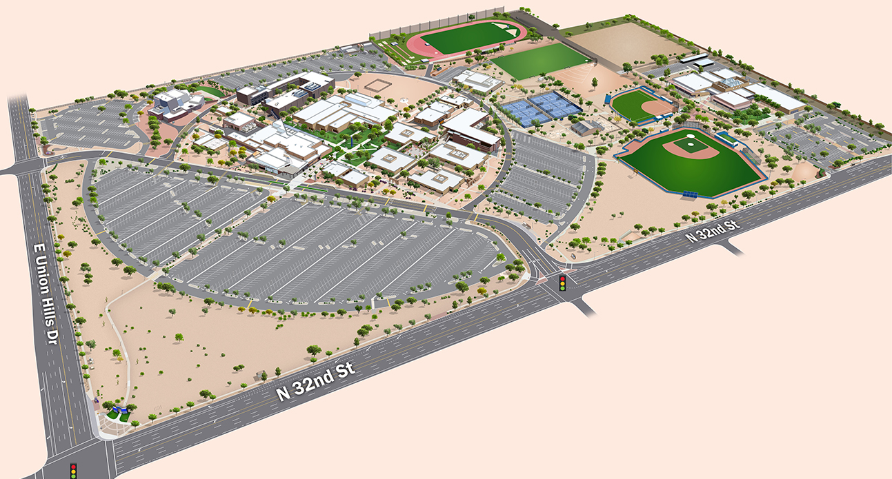
3D Vector Maps
Adding depth and dimension, our 3D vector maps elevate the cartographic experience. These maps are carefully designed to provide realistic representations of landscapes, making them perfect for navigation, planning, and visualization.
3D vector maps are indispensable tools for industries such as real estate, tourism, and virtual reality. By integrating advanced techniques, we create maps that are both visually appealing and functionally robust.
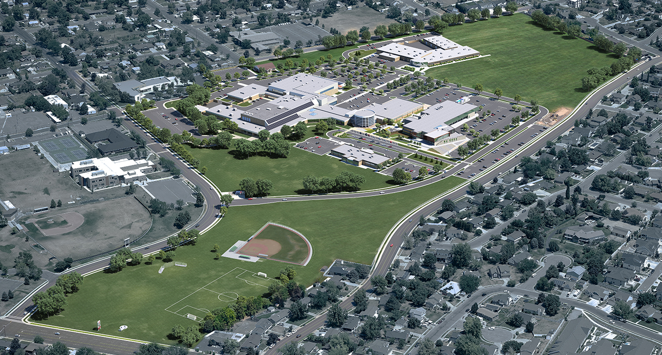
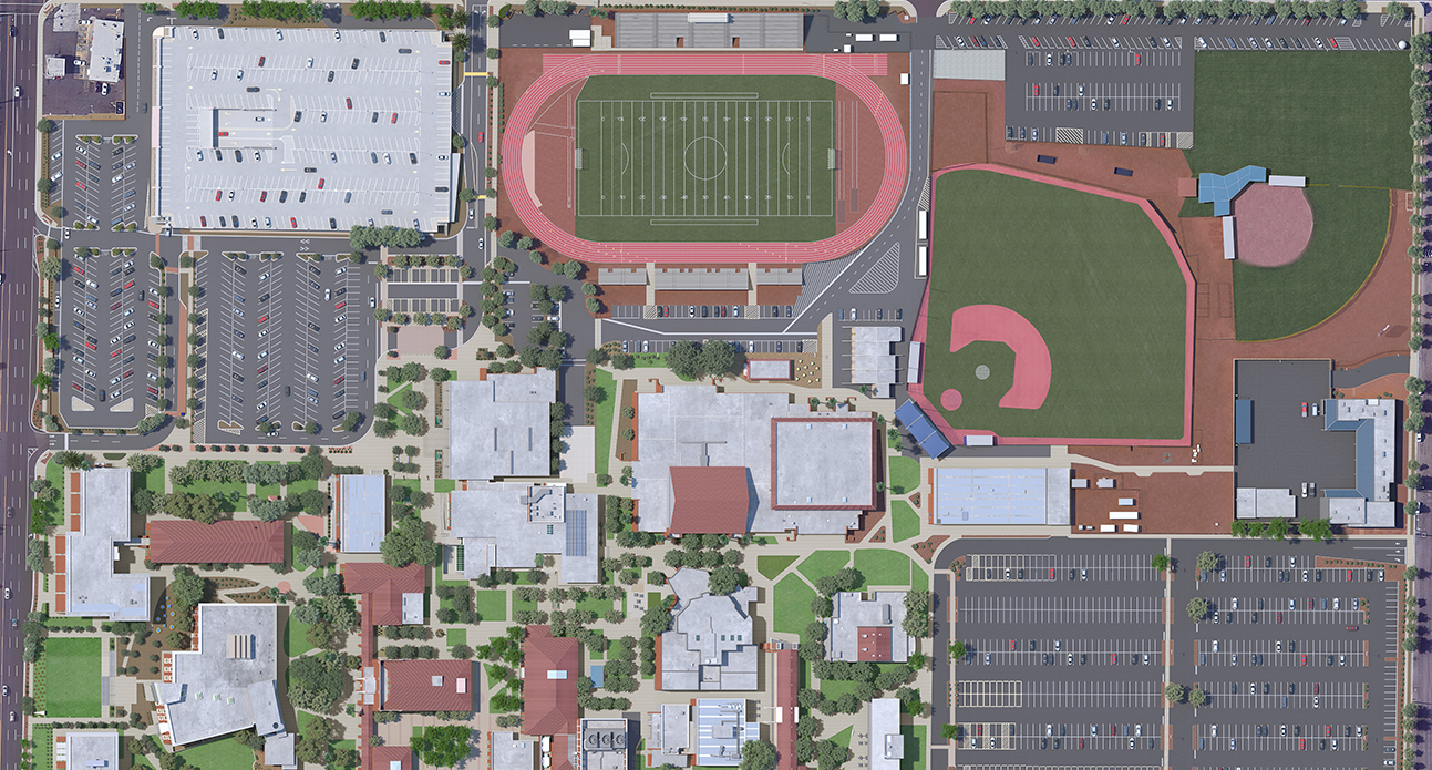
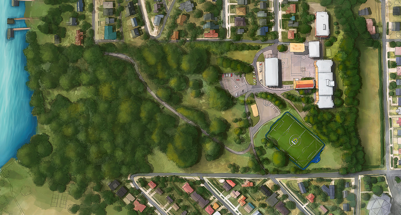
Photorealistic Maps
Our photorealistic maps offer unmatched realism, creating visually stunning illustrations that captivate viewers. Whether showcasing urban areas, natural landscapes, or hiking trails, our photorealistic map illustrations combine beauty with functionality.
Photorealistic mapping brings unparalleled depth to cartography. These map illustrations provide an immersive experience, helping businesses communicate their vision effectively.
Low Oblique Photorealistic Maps
Low oblique photorealistic maps provide a ground-level perspective, adding realism to landscapes. These maps are perfect for overlaying on Google Maps or geospatial applications. Real estate developers, architects, and urban planners benefit from these maps as they realistically preview sites from a human perspective.
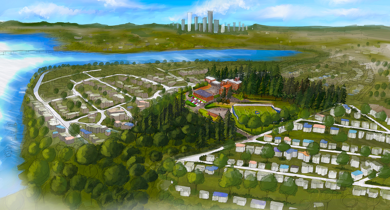
Freehand Illustrations (Isometric View)
Our isometric freehand illustrations offer a unique artistic touch. These visually appealing maps are suitable for architectural visualization, urban planning, and creative design projects, adding a distinctive perspective to cartography.
Freehand isometric maps offer a combination of artistry and accuracy, showcasing complex environments in an accessible format. These maps are ideal for presentations and design portfolios.
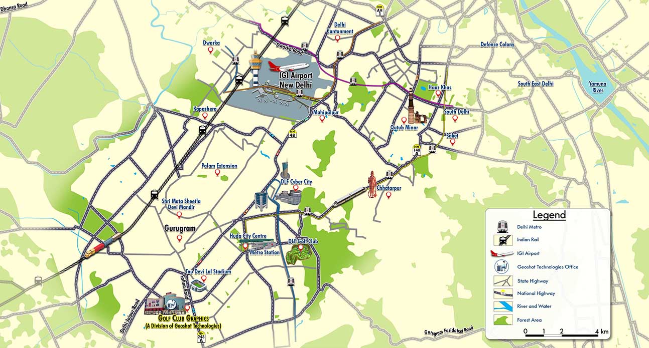
Location Maps
We create accurate and visually appealing location maps tailored for various purposes. These maps highlight important landmarks and provide clear directions, ensuring seamless navigation.
Location maps are essential tools for businesses and organizations aiming to improve accessibility and user experience. Let our world map illustrators design maps that guide and inform effectively.
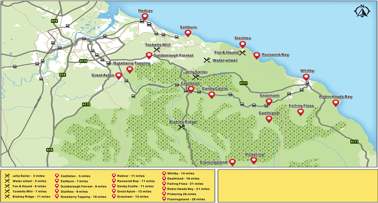
Tourist Maps
Our tourist maps enrich the travel experience by highlighting landmarks, points of interest, and essential information. These maps are designed to guide visitors while awakening their spirit of discovery, making them indispensable for the tourism industry.
Tourist maps bring destinations to life, offering travelers a clear and engaging way to explore new locations. By focusing on detail and creativity, we create maps that inspire exploration.
Freehand Illustrations (Top View)
For a classic and artistic approach, we provide freehand illustrations in top-view format. These maps capture the essence of a place with a hand-drawn aesthetic, making them perfect for editorial content and historical documents. Each illustration is meticulously crafted to reflect the unique charm and character of the location, blending intricate details with a timeless, artistic flair. The freehand style evokes a sense of nostalgia, offering a personal and human touch that modern digital designs often lack.
Discover the depth of our expertise in map illustrations services including landscape illustrations and real estate maps. Please visit our dedicated website
Why Choose GeoShot Technologies for
Map Illustrations?

Photorealistic Mapping
Our photorealistic mapping services bring realism to cartography, creating map illustrations that closely resemble actual photographs. This style is ideal for cityscapes, hiking trails, and detailed topographical layouts. Our maps are crafted to appeal to a wide audience, making them both visually stunning and highly informative.
Photorealistic maps offer unmatched detail, blending art with technical precision. These map illustrations are perfect for projects requiring visual impact and geographic accuracy, demonstrating why GeoShot Technologies is a preferred choice for businesses worldwide.
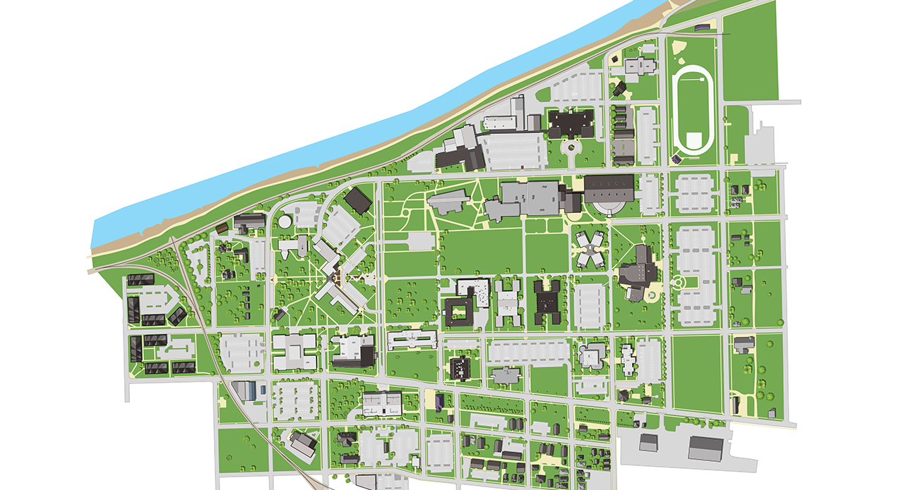
Expertise in Campus Maps
As skilled map illustrators, we specialize in creating meticulously detailed city maps. These maps provide a comprehensive overview of geographical features and points of interest, ensuring an organized and visually engaging display. At GeoShot Technologies, each project is treated as a unique masterpiece, combining creativity and precision to exceed expectations.
City maps are essential for urban planning, tourism, and education. Our expertise ensures that your map illustrations are both functional and visually striking, making us leaders in the industry.

Customized Mapping Solutions
We pride ourselves on delivering tailored solutions that cater to specific requirements. Whether you need artistic map illustrations or functional 3D vector maps, we guarantee results that align with your vision. Our commitment to quality and innovation makes us a preferred choice for map illustration services.
Customization is at the heart of our approach, allowing us to meet the unique needs of clients from various sectors. Trust our world map illustrators to bring your ideas to life with precision and creativity.
Advantages of Choosing
GeoShot Technologies
Versatile Expertise
Our team comprises talented professionals, including artists, architects, and cartographers, with diverse skills. This enables us to approach projects from multiple perspectives, ensuring a perfect blend of creativity, technical expertise, and attention to detail in every map.

Creative Vision
At GeoShot Technologies, creativity is at the core of everything we do. Our specialists are imaginative visionaries who transform ordinary maps into captivating works of art. This artistic flair ensures that our maps not only serve practical purposes but also engage and delight viewers.

Technical Precision
While creativity drives our designs, technical precision is equally important. Our team leverages its in-depth knowledge of cartographic principles to create maps that are accurate, reliable, and effective for navigation. This commitment to excellence sets us apart in the field of map illustration.
Transforming Cartography with Advanced Map Illustration Services
GeoShot Technologies is dedicated to redefining cartography through innovative and precise map illustration services. Our expertise in map illustrations, 3D vector maps, and photorealistic mapping ensures that every project meets the highest standards of quality and creativity. Whether you need a detailed world map illustrator for a global project or a custom solution for a specific location, we have the skills and technology to deliver.
Send a Message
