Geoshot...
Our
History
Welcome to GeoShot Technologies, a hub for cutting-edge technology solutions. Established in 2013, we are dedicated to revolutionizing various industries through advanced visualization and spatial analysis. We believe in transforming dreams into tangible visual experiences. Our team of professionals is driven to innovate how the world perceives digital visualization and Landscape Design Rendering through creative expertise.
Our Services
Here you can find all our services at one place
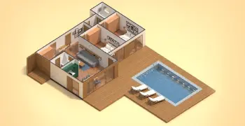
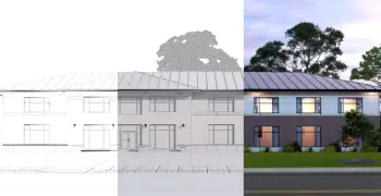
3D Architectural Visualization
Bring designs to life with photorealistic 3D architectural visualization, capturing every detail and perspective for presentations, marketing, or client approvals.
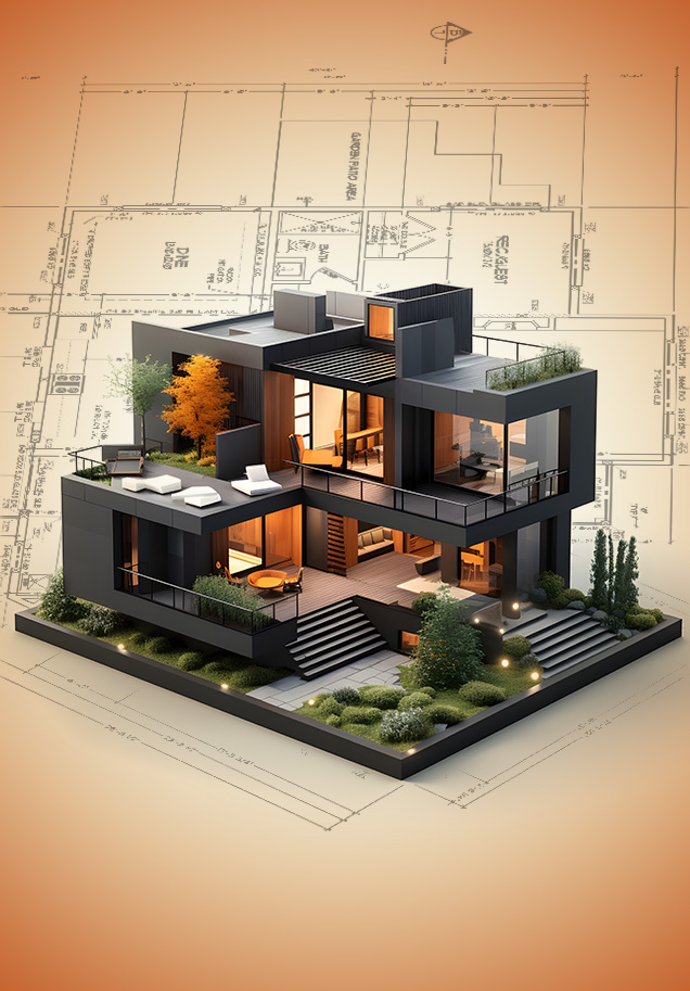
Augmented Reality 3D Modeling
Create immersive, interactive 3D models for augmented reality applications, enhancing visualization for marketing, training, or virtual showrooms.
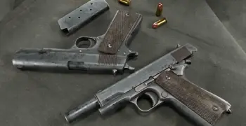
3D Modeling for Games
Create high-quality, optimized 3D modeling for games, including characters, environments, and props, tailored for immersive gaming experiences.
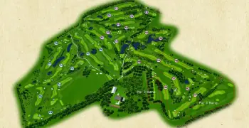
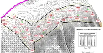
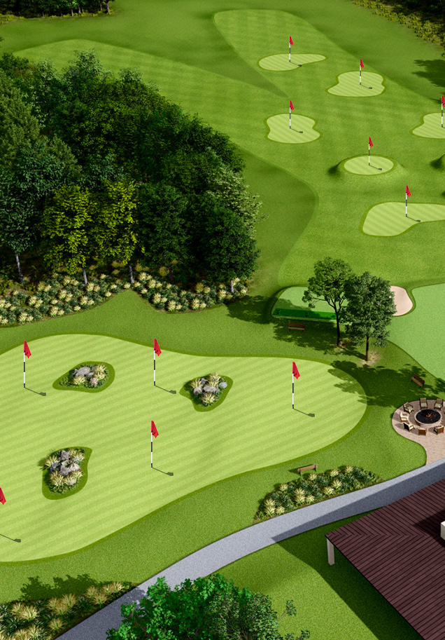
Golf Course Visualization
Design golf courses with precision, Golf Course Flyover, Golf 3D Still Render, and 3D Golf Graphics Design offering layouts and presentations for planning.
Geospatial Services
Using advanced GIS tools for accurate results, offer comprehensive geospatial analysis, including GIS Data Processing, LiDAR Data Processing, UAV Data Processing
CAD Drafting Services
Produce accurate and detailed CAD drawings for architectural, engineering, or construction projects, adhering to specifications. Golf CAD Drafting, Cut and Fill Calculation
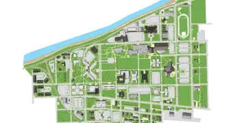
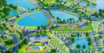
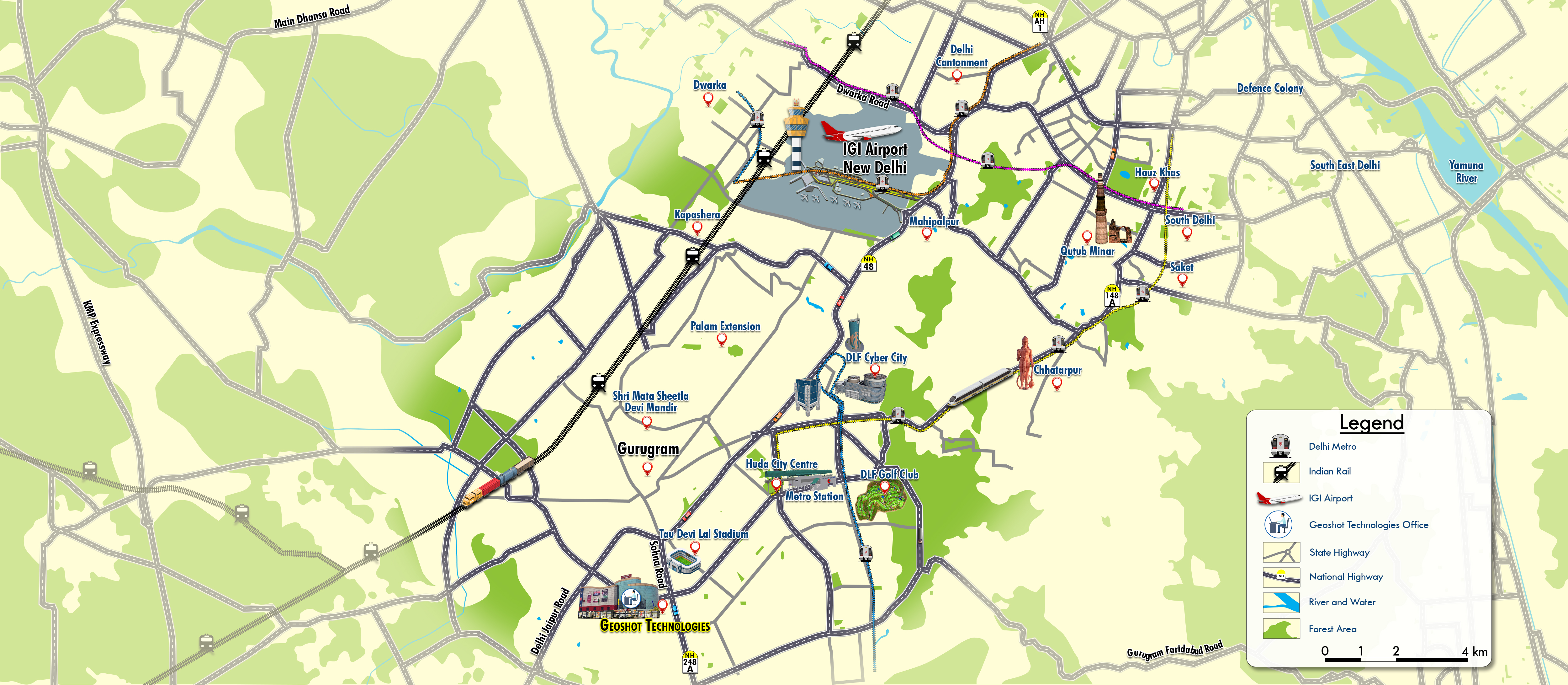
Map Illustrations
Design custom, detailed campus map illustrations for navigation, planning, or presentations in various styles and formats.
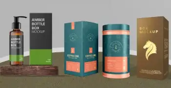
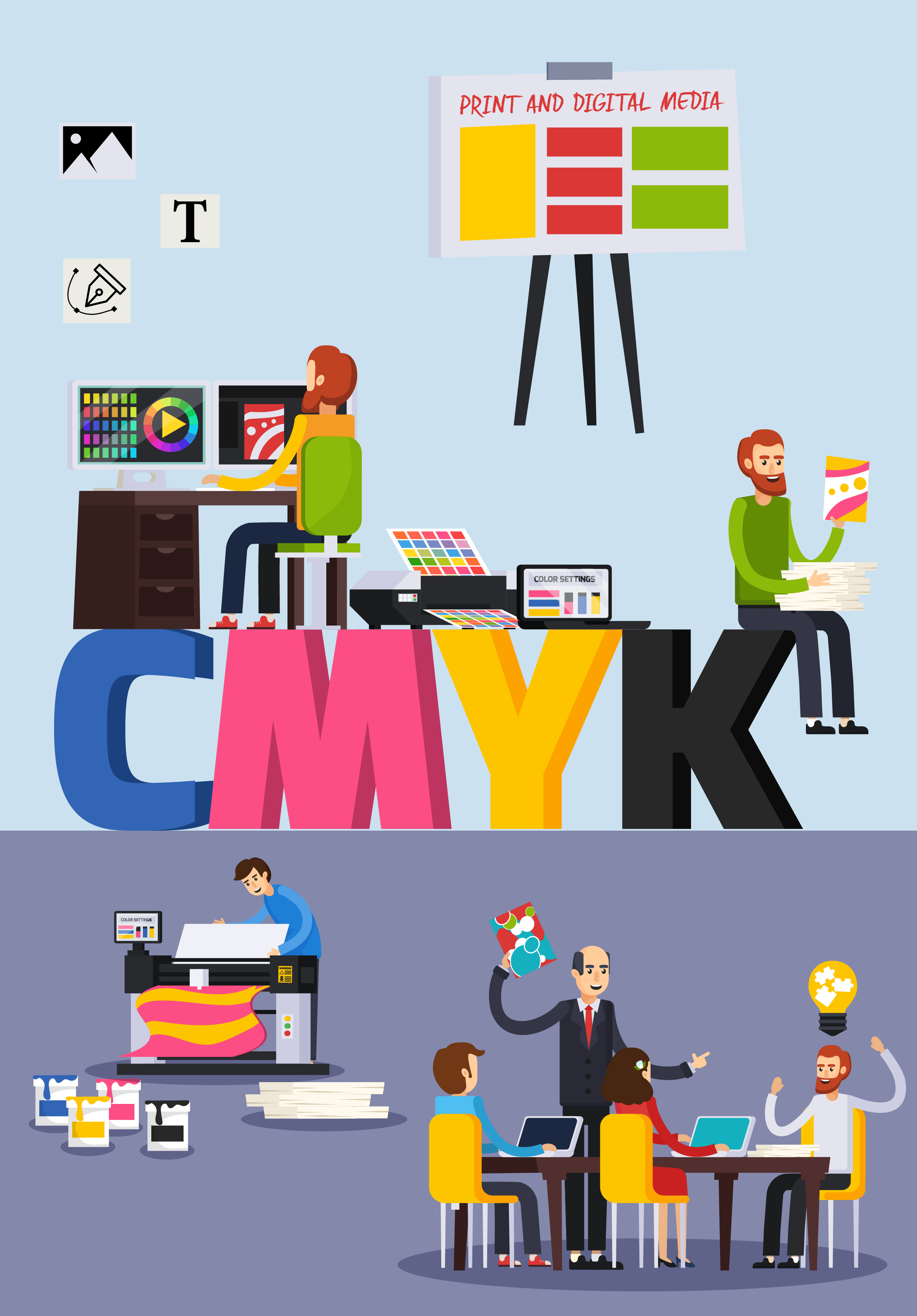
Graphic Design
Create visually compelling graphic designs for marketing materials, presentations, or branding, tailored to your vision.
Why Choose Us
Why Choose GeoShot Technologies?
Expertise in 3D Visualization
We turn your ideas into stunning 3D visualizations, delivering immersive digital experiences that help you see your projects in a whole new way.
.png)
Tailored Solutions
Our team creates customized solutions to match your unique goals, ensuring the best possible outcome for every project, whether it’s campus map illustrations or geospatial analysis.

Advanced Technology
By utilizing cutting-edge tools like CAD, GIS, and AR, we provide innovative and precise results, pushing the boundaries of what’s possible.

Industry Expertise
From architecture and real estate to gaming and urban planning, we offer specialized services to meet the needs of diverse industries.

Unwavering Commitment to Quality
We prioritize precision, reliability, and on-time delivery, ensuring every project exceeds your expectations.
Global Standards
Our services adhere to international quality standards, ensuring accuracy, reliability, and excellence in every deliverable.
Frequently Asked Questions (FAQs)
GeoShott is a leading provider of 3D visualization, campus map illustration, and geospatial
analysis services, offering innovative solutions for industries such as architecture, gaming,
real estate, and urban planning.
At GeoShott, we specialize in:
3D Modeling & Visualization: High-quality 3D representations.
Campus Map Illustrations: User-friendly maps for campuses.
Geospatial Analysis: Land development and planning insights.
Drone Mapping: UAV-based large-scale mapping.
LiDAR Processing: Topographic modeling and analysis.
3D Modeling & Visualization: High-quality 3D representations.
Campus Map Illustrations: User-friendly maps for campuses.
Geospatial Analysis: Land development and planning insights.
Drone Mapping: UAV-based large-scale mapping.
LiDAR Processing: Topographic modeling and analysis.
We create clear, attractive, and interactive campus maps that include paths, parking areas, and key landmarks.
Geospatial analysis provides insights through GIS mapping and spatial modeling to optimize land use and infrastructure.
We use CAD, GIS, LiDAR, and AR tools to ensure precision and data accuracy tailored to each client's needs.
Yes! We serve architecture, gaming, urban planning, education, real estate, and environmental sectors.
Timelines depend on the project scope, but we prioritize efficiency and provide regular progress updates.
Contact us via our website or phone to discuss your project. We're ready to help bring your vision to life!


TESTIMONIALS
Geoshot Technologies has a wonderful team to work with as they provide the best service. They are highly skilled and punctual. They are quick at making the requested changes. I would recommend people to partner with them.
Tech Enabler Hello AR
Siddesh L Jalageri
The team has been very professional throughout the project. I still remember some of the unrealistic deadlines we gave and delivered high-quality work to us on time. Bigyan’s special support during our initial phase has always been a support pillar for us. We wish the team only the best.
Co-founder & CEO Yodacart
Vikas Sharma
We partnered with GeoShot to create 3D images of several homes being developed for a new construction project. Their work was excellent, they adapted versions to suit our market and were very responsive when it came to turnaround times. I highly recommend Bigyan and his team!
Re/Max Hallmark
Marcus Plowright
Geo-Shot Technologies was able to deliver a superb 3D model for our projects in Dar es Salaam, Tanzania within the tight programs and to excellent standards. We highly recommend Bigyan Kar & his company M/s Geo-Shot Technologies for 3D imaging, 3D models 3D sectional elevations which provide excellent architectural overview of any building project.
Architect K&M Archplans Tanzania
Sunil Maru
I am thrilled to work with Bigyan and his team at GeoShot Technologies with whom I have worked for the past few years. They react quickly, efficiently, and with great passion to our requests and deliver work to the highest standards at all times. We will continue to enjoy their services in the coming years as well.
Director at EDI-Golf
JAMES EDWARDS
GeoShot Technologies provided all our company's mapping needs under tight deadlines and in a very professional manner. They are always willing to work with us to get the final result we require no matter how much effort it takes on his part.
Founder Agtech
Darren Wolchyn
Our Service Dedicated Websites


Send a Message
