
In order to create realistic and enjoyable experiences to plan for; market and even develop a golf course, golf course designers use 3D Visualisation. The process of converting raw data from a golf course’s topography into 3D visual representations, enables golf course architects, developers and clubs to accurately visualise the golf course’s layout, elevation and environmental features prior to construction or renovation. This process incorporates surveying, golf course mapping and advanced 3D environment design to provide an accurate and detailed 3D representation of the golf course’s landscape.
Collecting Accurate Terrain Data for Golf Course 3D Models
The foundation of any golf course 3D model lies in precise terrain data collection. This stage ensures accurate elevations, slopes, and contours, enabling designers to replicate real-world landscapes digitally with high precision and realism.
Using LiDAR and Drone Surveys
LiDAR and drone-based surveys capture millions of elevation points across the golf course site. These technologies provide highly accurate terrain meshes, helping designers model fairways, greens, bunkers, and water bodies with exact height and slope details.
Transforming Terrain Data into a Golf Course 3D Model
Once terrain data is collected, it is processed into a structured golf course 3D model. This step converts raw data into usable surfaces, contours, and base meshes suitable for advanced golf course mapping and visualization workflows.
Creating Digital Elevation Models (DEMs)
Digital Elevation Models form the base of the golf course 3D visualization. DEMs define height variations across the course, allowing designers to accurately simulate slopes, drainage patterns, and terrain flow essential for realistic course representation.
Golf Course Mapping and Layout Design Integration
Golf course mapping integrates course layouts with terrain models. This phase aligns holes, tees, fairways, greens, and hazards accurately within the 3D environment, ensuring functional design consistency and realistic spatial relationships.
Placing Course Elements and Features
Designers place bunkers, greens, cart paths, water hazards, and trees directly onto the 3D terrain. Accurate placement enhances visual realism and allows stakeholders to evaluate playability, safety, and course flow before physical implementation.
Applying Textures and Materials in 3D Environment Design
Texturing brings life to the golf course 3D visualization. High-quality materials simulate grass types, sand, water, and vegetation, creating visually engaging and believable environments that closely resemble real-world golf courses.
Realistic Grass, Sand, and Water Shaders
Advanced shaders replicate fairway grass patterns, bunker sand textures, and reflective water surfaces. These details enhance depth, lighting interaction, and realism, making the golf course 3D model suitable for presentations, marketing, and virtual walkthroughs.
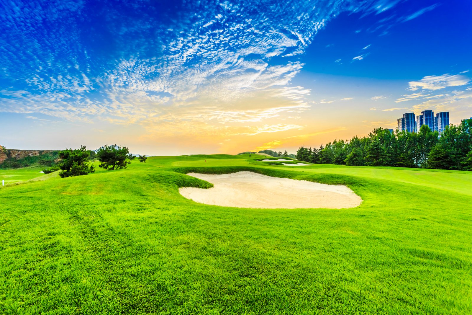
Lighting, Atmosphere, and Camera Setup for Stunning Renders
Lighting and atmospheric effects elevate the visual quality of golf course 3D visualization. Proper lighting simulates real-world conditions, while camera placement highlights course features and scenic views for impactful renders.
Day, Sunset, and Aerial Visualization Techniques
Designers create multiple lighting scenarios, including daylight and sunset renders, to showcase mood and ambiance. Aerial and flyover camera angles provide comprehensive views of the course layout, helping stakeholders understand scale and design intent.
Key Benefits of Golf Course 3D Visualization
- Enhances decision-making during course planning and redesign
- Improves communication between architects, developers, and clients
- Enables accurate golf course mapping and layout validation
- Creates high-impact visuals for marketing and presentations
Terrain Data to Render Workflow
| Stage | Purpose | Outcome |
| Terrain Data Collection | Capture elevation and contours | Accurate base landscape |
| 3D Modeling | Build golf course 3D model | Realistic digital terrain |
| Environment Design | Add textures and vegetation | Immersive visuals |
| Rendering | Apply lighting and cameras | High-quality final renders |
Final Rendering and Output Applications
The final stage produces polished visuals used across multiple platforms. These outputs support planning approvals, investor presentations, marketing campaigns, and virtual experiences, making golf course 3D visualization a powerful communication tool.
Marketing, Flyovers, and Virtual Walkthroughs
Rendered visuals are used in promotional videos, interactive flyovers, and VR walkthroughs. These applications allow golfers and investors to experience the course virtually, increasing engagement and confidence before development or launch.
Frequently Asked Questions

Founder & CEO
Bigyan Kar is the driving force behind Geoshot Technologies and has been since its founding, leading the company’s vision in delivering advanced CAD, GIS, graphics, map illustrations, and 3D solutions across multiple industries. While Geoshot serves a wide range of sectors, Bigyan has maintained a strong specialization in golf course graphics, CAD drafting, and mapping—ensuring highly accurate and visually compelling representations for golf architects and planners. His commitment to precision, visual clarity, and innovation has enabled Geoshot to produce high-quality 3D models, detailed maps, and comprehensive design visualizations for clients worldwide. Under his leadership, Geoshot Technologies has grown into a trusted partner for architects, planners, designers, and engineering teams by continuously investing in technology, talent, and workflow excellence. His ability to blend technical expertise with creative insight has established Geoshot as a leader in premium 3D visualization, CAD drafting, and mapping solutions across diverse sectors, with a distinguished reputation in the golf design industry.